
After the recent news and accompanying post time for some more positivity, cant dwell on too much out of my control so this is to detail some projects and commissions completed in the first six months of this year.
I was asked in January to complete an update of all the Purbeck schools cluster Orienteering maps by the Purbeck Sports Co-ordinator. There are 13 sites all over the Isle Of Purbeck, between Lulworth in the West, Bovington in the North and Swanage in the East. (Bere Regis is currently being rebuilt). When given this work, which was originally undertaken by Di Tilsley of the Dorset Outdoor Education Service (as was) my remit was to update her maps from sites that had building and more play equipment etc installed over the last 8 years.
In actuality the work became 12 Updates, and 3 brand new maps so a total of 15 maps on 13 sites. From this variety the most complex must have been Stoborough that had major extensions to the main building with multiple new rooms added. St Georges in Langton Matravers also had a new build to add as I wrote about earlier, and several needed no more than the playgrounds correcting. Lulworth Primary nestling below the ranges in West Lulworth was an entirely new map, made even more challenging by the fact that the Google Map photos show the site still under construction! Usually when starting a base map a screen grab allows the background that can be drawn on- no such luck there. Here’s a snip of that one-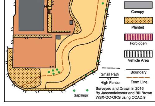
you can see the saplings have only just been planted, the fields were bare earth 6 months ago so what can be expected is this map to be become outdated is a short time. Since using the OCAD program I’ve been through several steps of frustration, spending hours working out how to operate the software, as every single point of detail, colour and point feature is an exact operation. My Cartography mentor Bill Brown from WSX has helped massively I owe him eternal gratitude. My latest work not only takes less time and pain, it looks better now as I don’t repeat actions and can interpret more as needed.
These map updates also came with advice on where the schools could fit their new Plaques supplied by Celtica, I walked all the grounds with P.E leads to see what made best sense for them to teach Orienteering on. Some of the schools were very keen to see me and the work being done, expectantly recieving them and getting into planning for the sport that provides for all individuals regardless of their enthusiasm for P.E, some needed persuading to allow me onto the school, such is the nature of schools work. I hope that teachers will gain lots of good sports sessions from these maps and advice, do let me know if you have enjoyed using them. We would hope that at some point the schools might run an inter- schools competition like the Dorset yearly event, or the P.E.D.D.S.A event I organised last year, the St Georges map would be ideal for this- HINT.
More locally in Poolemouth in the last couple of months I’ve also been busy setting up St Katharines Hengistbury Head map and course, great to have worked for them again, a school I worked with as Bike It officer for some years.
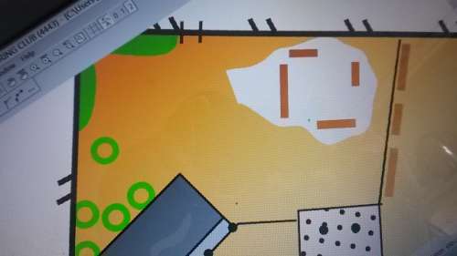
You may have also heard that Alexandra Park Poole, has been opened for Sports Hub use, a Bowling green and club house that had little or no use is set to become a local centre for lots of sports, including Maprunning. This one when I heard became a must-map, its a superb site for introductory Orienteering, with deep valleys and mature woodland. This map snip shows some of the area, really looking forward to working with Harbour Challenge on this site.
Last week another school Ive provided Bikeability for contacted and so Im mapping St Marys Poole for Orienteering use, this one has a perimeter adventure trail through the woods, sandstone boulders, mature pines and gorse- in fact its like a miniture piece of Dorset Heathland within the site. Brilliant to get asked to do this work, if you have read this and got inspired do get in touch or pass on.
The week ahead I will be going in to deliver another 5 days activities for Durweston which started last year, we’ve luckily been given Bryanston school to use for one of these days, that should be a treat for all maprunners, lets hope the end of June sun keeps shining. Sorry for not blogging more, Summer Term 2 always keeps me busier than ever in the outdoors.
Reasons to consider making maprunning happen in your school:-
KS2 Geographical Skills and Fieldwork Curriculum Autumn 2016
- Use maps, atlases, globes and digital/ computer mapping to locate countries and describe features studied.
- Use the 8 points of a compass, four and six figure grid references, symbols and key (including the use of Ordnance Survey maps ) to build their knowledge of the United Kingdom and the wider world.
- Use fieldwork to observe, measure, record and present the human and physical features in the local area using a range of methods, including sketch maps, plans and graphs, and digital technologies.