
We are at the pre-season period for Orienteers, there are events all year these days, summer relays and participation events- but this is the time just before the full season starts initiated for me by the Caddihoe Chase which is the South Wests’ October weekender. Orienteering traditionally was always based around races in Forests- originating as it did in Sweden, that frame is moving internationally to include more Urban racing and Sprint racing, short faster more complex maps that force even more decision making at speed. This is due in part in U.K to the availability of forests, and contestation over use for leisure activities. New Forest locally is specially subject to this pressure for recreation. Forested sand dunes featured as the premier reason for runners to attend the 5 day summer event in Wales this year, to many in the sport the most exciting place to compete, mine too so this post answers the question of the title with details from a re- run I did whilst on holiday in Scotland.
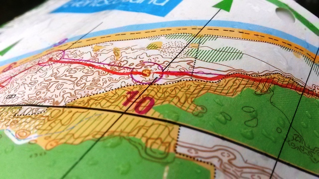
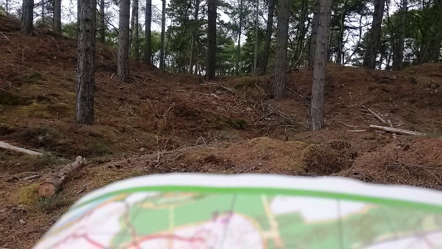
There are lots of the types of forest you can probably picture in the U.K, with fire trails through them, these gravel tracks are good for cycling too. Forestry commission areas tend to be large blocks of trees, under different levels of development and age, more and more these are being cleared for tree pulping. Forested sand dunes are perhaps the rarest type of environment found around the coasts on U.K, what makes these interesting is they have mature tree areas that are shown on our maps as white, underlayed with the shapes of sand dunes, very intricate areas that make for fantastic competitions. The challenge of successfully navigating around these places is superb, as always its a solo challenge- whilst there will always be a number of competitors on you’re course yours is timed separately from the rest. This is what serious Orienteers put themselves up against–Pictures here from Culbin Forest, the location of Day 3 of the Scottish 6 days 2013. My revisit included getting into the competition area using O.S maps then a re run of my course from that year.
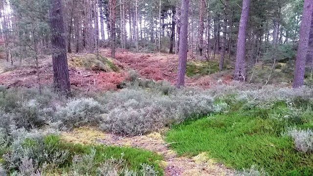
So-Large Depression might be what you feel when unable to find your control, but its also the description of this place which is a very small clearing within open forested dunes. With 2.5 meter contour lines there are heaps of micro locations here which test you’re ability to manage pace, whilst homing in on target location.
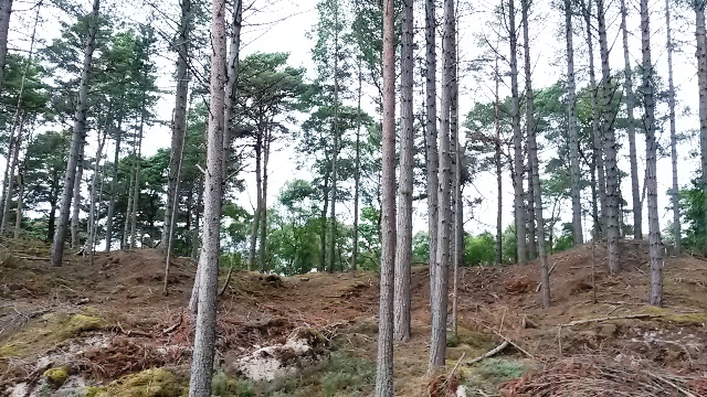
This one shows perfectly a dune ridge on which the control description is Central re-entrant, a small dip of only a couple of metres- just discernable. Navigating on Earth features like this is the most skilled and rewarding when you get it right – which isnt all the time!
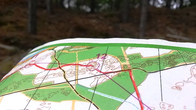
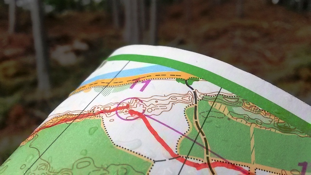
Heres another Control 12, looking into a larger area of small earth features with control description Central Small Hill South East side. I was 2 minutes 20 seconds between 11 and 12, a good leg. So this is it, micro navigation at speed, one of the many reasons to go Maprunning- Bring on the season.