
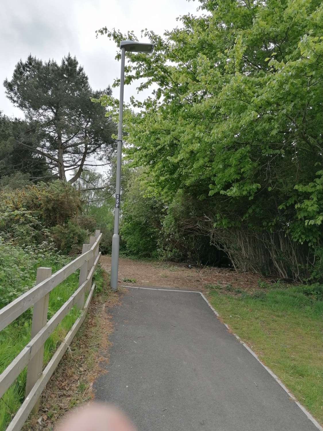
Update 04 May 2020. Fence removal and clearing done
Update- 16 January 2019, this area has been identified as needing Bridleway access- very good news and directly responds to this blogpost! Please add comments about Active Travel / Horseriding/ Cycling/ Walking and send to rightsofway@poole.gov.uk by 13th Feb 2019 Scroll down for my observations March 2018
Short blog on this area that Ive been working in since 2008, I was out exploring (as always) yesterday also to see what locations might change for cycle training Canford Heath and Haymoor Juniors school children and looked at the Bellway homes estate accessibility, incredible whats been built there. Daily Echo wrote about this estate in 2008 and it seems the homes are now all full. I’m coming at this from a transport angle of course, trying to understand why the roads are actually so crazy full up at every peak/school run time. Read on. You can see the Google Earth Image here is a couple of years old,
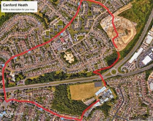
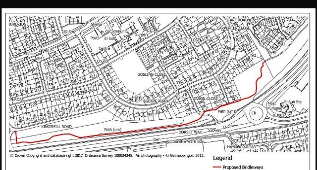
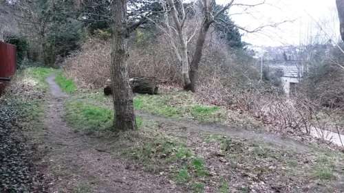
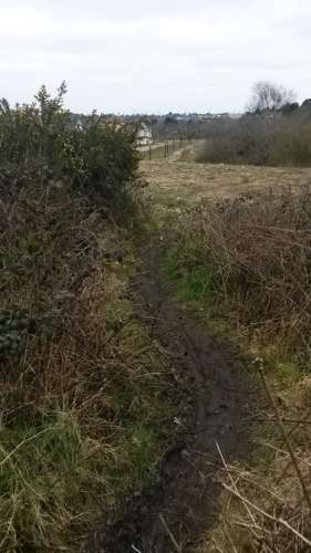
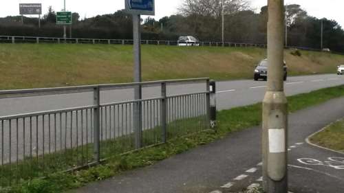
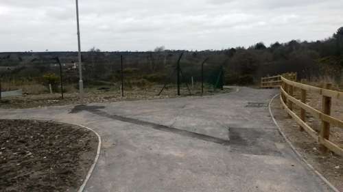
the building site is now finished and has these black methane ducts around the outside as it was build on a landfill site (see Echo piece). Ive been interested in how other countries build estates where all journeys on them are either originating or terminating avoiding the creation of rat runs like Sherborn Crescent also on Canford Heath. So first impressions this estate seems to be going the right way, maybe kids can play outdoors in their new estate. New Build areas are supposed to consider the travel possibilities for residents, I’m sure Bellway did yet what is there now is effectively ghettoised, as there are no exit/ entry routes for walking or cycling at all other than the main entrance used by all motors. When you look closely what transpires is quite exceptionally dire from an active travel perspective. This Blog is centred on the area close to the roundabout on G Earth picture. You can fight youre way through scrubland and good old Dorset Gorse but not everybody is an Orienteer so the given route by road mixes with every single other person who goes to school/ work in the car. If I had a child at St Edwards School (1146 students) which is the secondary that both primaries feed into and lived on what Ill call the Kellaway Estate theres a couple of options for getting to school. Walk, out the estate onto Verity Crescent, Scarf Road and under the A3049 underpass. About 400 Metres, not too bad except in the dark. Bike, same distance and route. Drive, Red Line on photo 2000 Metres (over a mile) down Adastral Road under the A3049 turn left up Dale Valley road. Thats what most people do and they cant be blamed as look what has been put into the estate. Clearly a very few local intrepids go on the desire line shortest route- this first picture is by the A3049 underpass next to the roundabout. Unfortunately when you emerge out the other side (bottom picture) you hit the dirt and have to climb a fence to get in the estate.
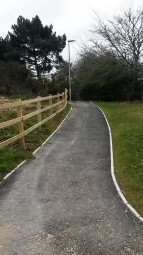
Now have a look at the photo southbound from inside the estate, where the walking /cycling tracks just end- they head towards the exact direction of St Edwards which is 300 metres and the underpass, Red Short line but…
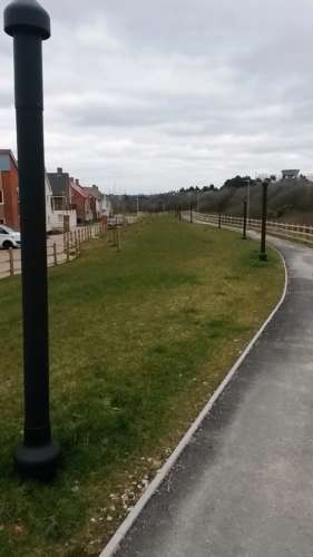
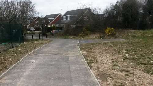
From the same spot looking north with the Dorset way alongside, these tracks go right around the estate, But exit into the back of Verity crescent, and dont connect with the two pedestrian overbridges further north over Dorset Way into Mannings Heath industry or Tower Park
So given this building are you surprised that vast majority of people drive onto Adastral Road for a 2 kilometre journey to school rather than a possible 300 metres walk? Try going around there at peak times and youll see its already totally congested, gridlocked and all the other unpleasant words that people use to describe everyday life on U.K roads. No surprise. Why didnt the builders give the residents better opportunities to get to work or school on two feet or two wheels? I’m sure the fenced area that is to become the pond and nature area of Kellaway will be great, its just a failure to enclose the area so completely. Perhaps the new National Planning Policy Framework (sustainable development) which has just been announced might alleviate this, included in paragraph 105 is reference to the upcoming LCWIP (Local Cycling /Walking Infrastructure Plans) which our upcoming joint Council (BCP) will be adopting August 2019 after a years consideration from Cycling Officers. Have a great Friday thanks for reading comments appreciated.